Navigation Apps:
The best way to navigate is to use an app on your phone. The app I use is Gaia GPS, but you can use others too. The free version is fine. You can download a gpx file from this web site onto your app and it will show you the route and your location on the route. You do not need cell service to have it track you, BUT you must download the file into your app AND make sure you have charged your battery. It's not a bad idea to turn off your cellular signal when you are running because looking for signal uses up battery pretty quickly. If you have never used a tracking app before, I suggest you try it a couple times while doing a route you are familiar with before relying on it for navigation. You can use the app to navigate to the start, or just use these directions.
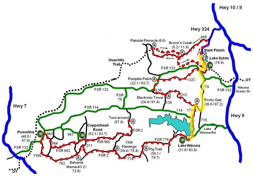
Start this run from the Lake Sylvia Day use parking area.
Notes for this run:
Water is usually on in the summer at the Lake Winona Parking area bathrooms where you turn around. However, it can be of questionable quality. I've always drunk it with no problems, but I'd let the water run a minute before filling my bottle.
HOME AURA NEWS UTS Back to Trails