Before you read any of this race information - please be sure you have read this first.
The Athens-Big Fork Trail Marathon and Blaylock Creek 17 Mile Fun Run take place on the Athens-Big Fork Trail. This is actually > 100 year old horse postal trail. After running this, you will wish you had a horse!
The race starts at the Big Fork Community Center located on Hwy 8 on the eastern side of the town of Big Fork. See Google Map.
Google Maps Driving Directions to race start.
The course is an out and back course. You first run 2-1/2 miles on roads - paved and gravel up to the start of the trail. Then you enter the Athens-Big Fork Trail - White Blazes. Follow the trail over 8 mountains.
The 8 mountain crossings on the trail are:
- Missouri
- Hurricane Knob
- McKinley
- Brier Creek
- Leader
- Brushheap
- Brushy
- Big Tom
You pop out of the trail and need to go about a half mile down the gravel road to get your full 13.1. Then you turn around and go back. It's that easy!
The 17 Mile Blaylock Creek Fun Run only gets to run half of the hills. You will turn around at the Aid Station just across Blaylock Creek.
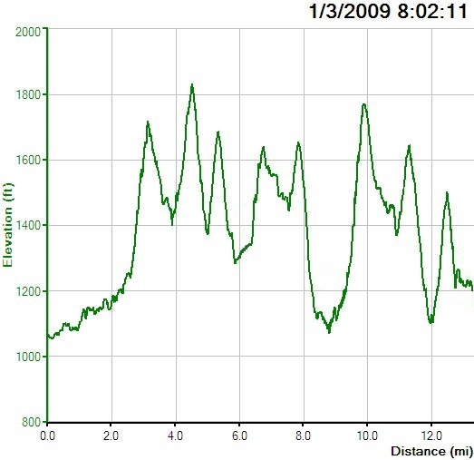
What this means to you the runner. Here are some statistics for you to consider - this is the "out" of the out and back:
Max Elevation: 1850
Min Elevation: 1050
Climbing Elevation Gain: 4600 feet
Climbing Distance: 7.10 miles
Average Grade: 12%
Elevation profile for first half (from Start to Turnaround at mile 13.1).
The US Forest Service has a map on their website - Click Here to view/download.
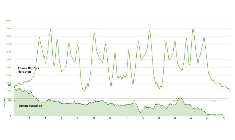
Compare ABF to Boston Marathon
|
